2.1 Introduction
From 6 to 9 August 2012, a period of intense rainfall hit Luzon, the northern main island of the Philippines. In particular, it affected Metropolitan Manila, a region of about 640 \(km^2\) and home to a population of about 12 million people. The torrential event resulted from a remarkably strong and sustained movement of the southwest monsoon, locally known as Habagat. The extraordinary development of the Habagat was caused by the cyclonic circulation of Typhoon Saola (local name Gener) from 1 to 3 August and was further enhanced by Typhoon Haikui, both passing north of the Philippines. This mechanism was already discussed by Cayanan et al. (2011). In the following, we will refer to this event as the Habagat of August 2012.
The event caused the heaviest damage in Metropolitan Manila since Typhoon Ketsana hit the area in September 2009 (Abon, David, and Pellejera 2011). The Habagat of August 2012 particularly affected the Marikina River basin, the largest river system in Manila. Rain gauges in Metropolitan Manila recorded anywhere from 500 to 1100 mm of rain from 6 to 9 August. A total of 109 people have been confirmed dead. Over four million people were affected by the flood (NDRRMC 2012).
Despite these numbers and despite the tragic and massive impacts of this flood event, the present study suggests that Metropolitan Manila might have escaped a bigger disaster just by a few kilometres. This analysis was made possible by using the recently established network of Doppler radars of the Philippine Atmospheric, Geophysical, and Astronomical Services Administration (PAGASA) and other meteorological data provided through the country’s Project NOAH (Nationwide Operational Assessment of Hazards). The Habagat of August 2012 was the first major rainfall event after the implementation of this project.
In this paper, we will present a first reconstruction of the rainfall event. It is the very first time such an analysis is shown for the Philippines, and it illustrates the immense potential for flood risk mitigation in the Philippines.
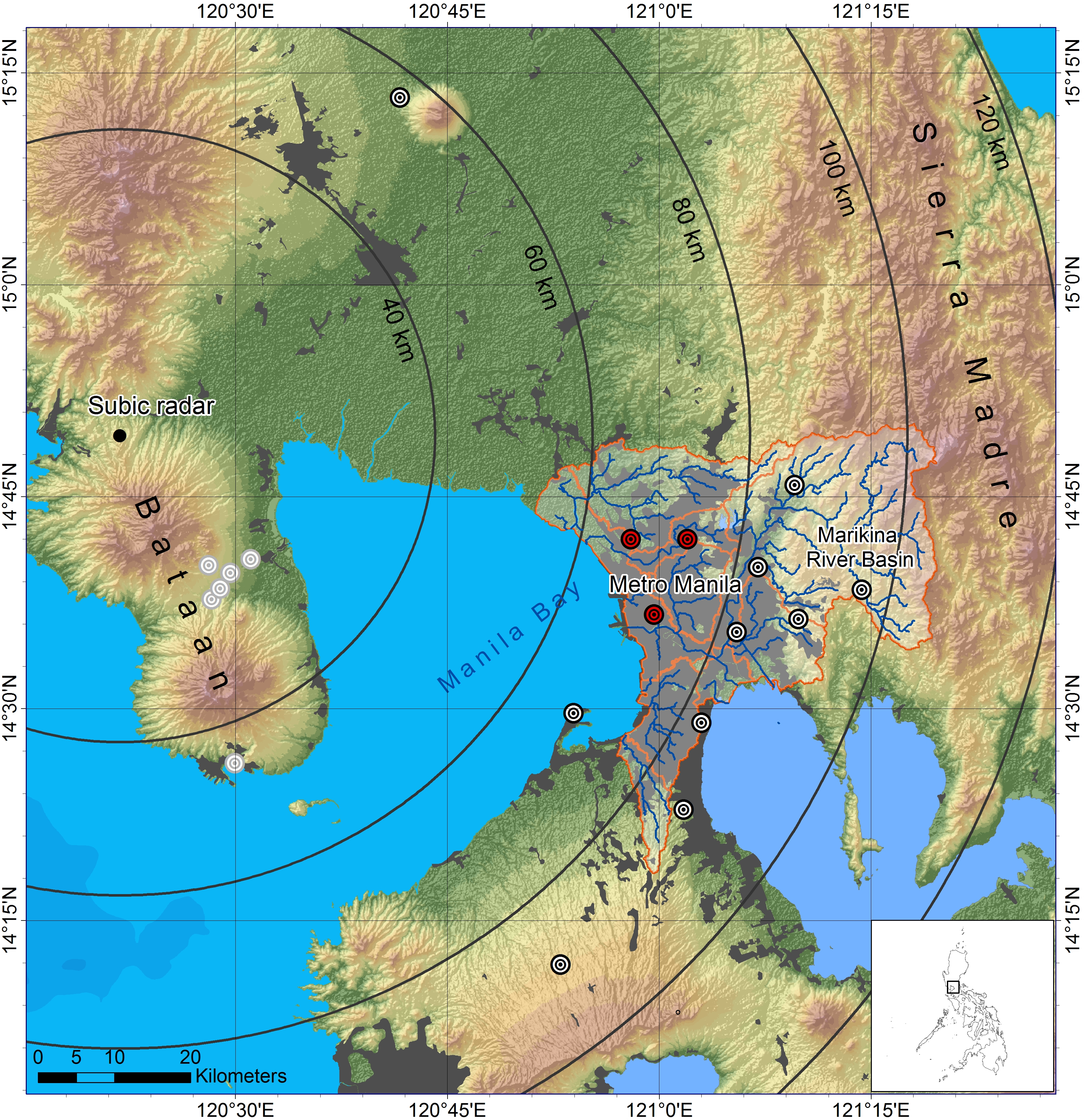
Figure 2.1: Geographical overview of the area, including Subic radar, different radar range radii as orientation, and the NOAH rain gauges (small circles). The red circles are the gauges shown in Figure 2.2. The gauges with grey circles have been ignored in this study, because the entire Bataan Peninsula is affected by massive beam shielding. Urban areas (including Metropolitan Manila) are shown in grey. Major rivers (blue lines) draining to Metropolitan Manila are shown together with their drainage basins (orange borders).
References
Abon, C. C., C. P. C. David, and N. E. B. Pellejera. 2011. “Reconstructing the Tropical Storm Ketsana Flood Event in Marikina River, Philippines.” Hydrology and Earth System Sciences 15 (4): 1283–9. https://doi.org/10.5194/hess-15-1283-2011.
Cayanan, Esperanza, Tsing-Chang Chen, Josefina Argete, Ming-Cheng Yen, and Prisco Nilo. 2011. “The Effect of Tropical Cyclones on Southwest Monsoon Rainfall in the Philippines.” Journal of the Meteorological Society of Japan 89A: 123–39. https://doi.org/10.2151/jmsj.2011-A08.
NDRRMC. 2012. “NDRRMC (National Disaster Risk Reduction and Management Council) Update: SitRep No. 20: Re Effects of Southwest Monsoon Enhanced by Typhoon Haikui.” http://reliefweb. int/sites/reliefweb.int/files/resources/PDF1_132.pdf.